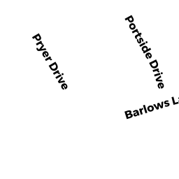
4 PORTSIDE DR
Owner Information
EAVES PAUL J ETUX
1 CATALPA ST
SAUGUS, MA 01906


Property Details
4 PORTSIDE DR is classified as a Single Family Residential (Raised ranch).
The primary structure on this property was built in 1976. There are 1,082ft2 of built area within this property. There is 1,082ft2 of residential/living space within this property. This property is listed as having 5 rooms.
4 PORTSIDE DR is valued at $273,200. The land is valued at $130,700 and the structures are valued at $142,500.
This property is in Zone 1. Confirm with local Zoning Board authorities to ensure there are no overlays or other easements on this property.
4 PORTSIDE DR was last sold on Monday, February 13, 2017 for $260,000.
Assessment data from fiscal year 2020.
Flood Data
According to the FEMA National Flood Hazard Layer, this property does not appear to be in a flood zone. It may also be in an area not yet reviewed. Nonetheless, confirm this information prior to taking any action.
To view the flood hazards around this property, create a FEMA "Firmette" Map of the area around 4 PORTSIDE DR.
Broadband Internet Providers
| Provider | Type | Bandwidth (mbps) | |
|---|---|---|---|
| HughesNet | Satellite | 25 | 3 |
| Viasat Inc | Satellite | 35 | 3 |
| VSAT Systems, LLC. | Satellite | 2 | 1 |
| Verizon New England Inc. | DSL | 5 | 0 |
| Comcast | Cable | 1000 | 35 |
| T-Mobile | Fixed Wireless | 25 | 3 |
| GCI Communication Corp. | Satellite | 0 | 0 |
Broadband service provider data from December 2020.
Adjacent Properties
- 4 SCHOONER LN
Single Family Residential owned by CROGAN LYNNE R - 6 SCHOONER LN
Undevelopable Residential Land owned by SAVAGE EDITH A - 56 BARLOWS LANDING RD
Single Family Residential owned by LASCARI ELEANOR M - 2 PORTSIDE DR
Single Family Residential owned by WARD PETER & - 6 PORTSIDE DR
Single Family Residential owned by LOSOWSKI JANE E & ELEANOR I